Subproject 1: Remote sensing

The project comprises the creation of a geodatabase, the analysis of geodata on geo- and environmental risks, the collection of drone data for selected areas and the development of a WebGIS. The aim is to collect, analyse and use geodata to assess and manage risks in the Main Valley.
Work package 1: Development of a geodatabase
Freely available geodata for the Main Valley will be collected and integrated. This includes official data, administrative information, environmental data (e.g. from the Bavarian Environmental Atlas) and remote sensing data from the Copernicus programme (mainly Sentinel-1 and Sentinel-2). The database is continuously updated and integrated into a standardised GIS.
Work package 2: Analysing selected geodata in relation to geo and environmental risks
The data collected and harmonised in WP1 will be further processed and analysed in WP2 for a multi-hazard analysis. This includes Creation of a high-resolution temporal series on urban development and infrastructure changes with a focus on soil sealing.
Derivation of trends for air temperature, precipitation and other parameters using ERA5-Land Reanalysis data. Integration of MODIS data for land surface temperature and vegetation indices.
Spatial evaluation of the DWD data set CatRaRE for heavy precipitation in terms of intensity, duration and trends at administrative and catchment level.
Implementation of high-resolution hydrographic modelling for the entire study area with derivation of catchment areas and integration of information on flood areas and historical floods.
Preparation of a susceptibility analysis using landform classification to identify key locations for gravitational mass movements and flash floods.
Work package 3: Collection of drone data for selected study areas
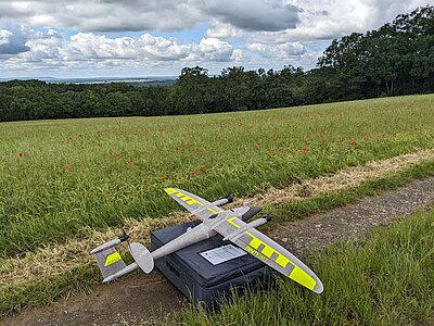
For selected sites such as the Sailershausen University Forest, drone flights will be carried out to support the planned project work. In particular, LiDAR data will be collected to obtain vertical structural parameters of the vegetation. Repeated aerial surveys can be used to characterise the temporal dynamics of vegetation development. These data are particularly relevant for the work of the Müller WG (succession, undergrowth and browsing) and the Terhorst WG (afforestation, georisks on slopes). Includes flight planning, aerial surveys, data collection, processing and provision of geodata products for further analyses.
Work package 4: WebGIS
Data from WP1 and WP2 will be transferred into a simple WebGIS application.
Contact persons and deputies:
- Prof. Dr. Tobias Ullmann (Subproject management)
- Prof. Dr. Hannes Taubenböck (Subproject management)
- Sebastian Buchelt (Project staff)
- Dr. Mirjana Bevanda (Drone team)
- Debray, Henri
- Droin, Ariane
- Jheng, De-Cyuan


