Current research projects
AReS - Anthropogenic signatures in reservoir sediments: the past century

Due to their high accumulation rate and undisturbed sedimentation conditions, reservoirs form an excellent landscape archive for the Anthropocene. As part of the project, sediments from five reservoirs in the northern Eifel region are being examined in detail in order to reconstruct both human and climatic influences over the last 100 years.
Turning Exorheic – Capture and Fluvial Incision of Basins Under External Forcing (Ex-CaLIBUR)

Ex-CaLIBUR addresses a major gap in Quaternary basin research by investigating the poorly constrained dynamics, timing, and external controls of the endorheic-to-exorheic transition and subsequent drainage evolution. Using morphochronology plus in situ terrestrial cosmogenic nuclide (TCN) dating in Spain’s Guadix-Baza Basin, it will date key glacis and terrace deposits to narrow capture ages, track how the capture signal propagated across segmented subbasins through morphometrics, and test whether terminal glacis aggradation was diachronous to distinguish progradation from headward capture—yielding broadly transferable insights and methods.
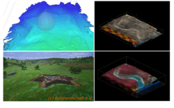
Natural hazards in high mountains – 3D model of the Blaueistal valley

Climate change is increasing the risk of natural hazards in high mountain regions. Rockfalls and landslides in particular are becoming more frequent. To better understand these processes, the University of Würzburg created a high-resolution 3D model of the Blaueistal valley in the Berchtesgaden Alps in the summer of 2025. With over five million laser measurement points, it accurately depicts the valley floor and steep rock faces. Future measurements will show where the landscape is currently changing and which areas are particularly at risk.
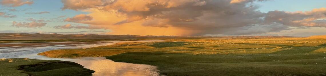
115 years of sedimentation in the Urft Reservoir

The sediments of Lake Urft represent a unique archive of human influence on the late Holocene sediment composition. The reason for this is that the sediments in the lake have been deposited almost undisturbed over the last 115 years. Due to construction work on the Urft dam and the inspection of the 2.7 km long Kermeter tunnel, which drives the Heimbach hydropower plant, the reservoir was almost completely drained in November 2020. This provided a rare opportunity to sample the deposits in detail and to photogrammetrically record the entire reservoir using an unnamed aircraft (also known colloquially as a drone, or UAS for Unoccupied Aircraft System). The work was carried out in collaboration with the Eifel Rur Water Board (WVER).
.")
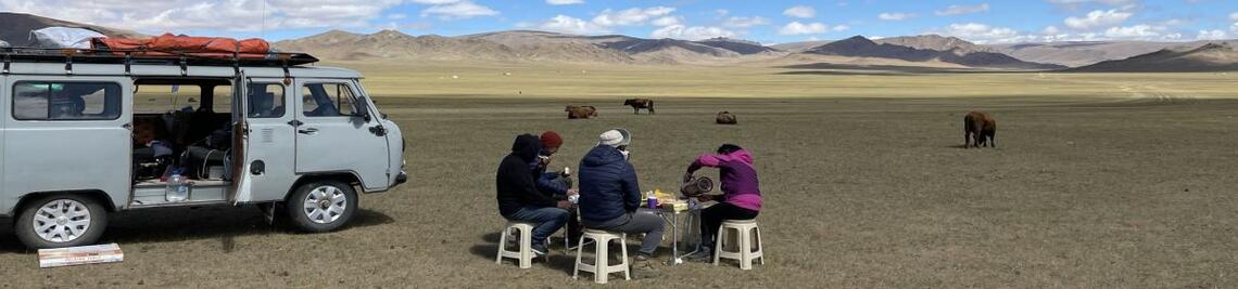
Surface Roughness Estimation in arid regions from Sentinel-1 radar data
The world's arid regions were and are particularly susceptible to climatic changes. At the same time, they are the habitat for more than 2 billion people. Due to the size of the areas, the poor infrastructure in many areas and the often adverse environmental conditions, there are still large gaps in the state of research on the rates of landscape change. Remote sensing data has been used intensively for several decades to monitor drylands. However, optical remote sensing methods often reach their limits when it comes to geomorphological processes and process rates. This project is therefore investigating the suitability of radar data for characterising surfaces.

Smartphone-supported mapping of landforms
Understanding 3D properties of objects is an integral part of geomorphological teaching. This can best be achieved during field trips. However, there are numerous reasons why teaching outdoor might not be possible, either for a group of students or just individuals. 3D models of landforms, either static or interactive, are a great method to improve students learning success, e.g. in a blended learning environment. Preparation of 3D models of individual geomorphological landforms has been so far time-consuming. But since 2020, LiDAR sensors have been integrated into some new smartphones. These systems offer great potential for geomorphological teaching, as they enable simple and cost-effective recording of geomorphological landforms and objects in three dimensions. The smartphone LiDAR systems are suitable for the documentation and 3D reconstruction of objects in the range of several decimetres to metres. All in all, these smartphone LiDAR systems offer great potential, as they support the understanding of the three-dimensional structure of geomorphological landforms and objects in teaching in schools and universities and thus increase the success of teaching among pupils and students. Furthermore, 3D models make geomorphology more inclusive, e.g. for people not able to conduct field work. At the same time, in research, they offer new opportunities for scientific observation projects, e.g. through the continuous monitoring of geomorphological changes in the context of Citizen Science projects.
GEO-XR: XR for geographical spatial analyses
The project is part of the funding initiative ‘WUEDIVE - Digital Innovation in Teaching’ of the Centre for Scientific Education and Teaching (ZBL) and will deal with the possibilities of making landscape development processes, which often take place far too slowly for human perception (e.g. formation of river terraces, draining of marshlands), tangible in time-lapse and visually appealing with augmented reality techniques (VR and AR).

The Geomorphology-Sandbox
The sandbox is used to simulate various geomorphological processes on a small scale.One focus of the simulations is on fluvial-geomorphological processes.For example, the causes and consequences of flood events can be visualised.
High-precision laser scans enable the creation of 3-D models. Multi-temporal time slices of the geomorphological forms are used to calculate sediment balances. The digital models can be used to precisely determine local erosion and accumulation events.

CRC 1211 – C02 – Transport and deposition
Due to the direct coupling of alluvial fans (AF) to the source area, they present quintessential depositional features and preserve responses of the sediment routing systems to palaeoclimatic variability, tectonic activity and base-level changes in their architecture and stratigraphy. However, the impact of autogenic controls governing the AF internal dynamics make it challenging to decipher these allogenic environmental controls. AF are widespread in the Atacama Desert from its arid margins to its hyperarid core and, thus, provide great potential to link and compare these morphodynamic systems with other existing regional palaeoenvironmental archives – of which many have been and are planned to be further investigated within the DFG-funded Collaborative Research Centre 1211.
Project bundle: Inclusive and Integrated Multi-Hazard Risk Management and Engagement of Volunteers to INCREASE Societal Resilience in Times of Changing Climates
- subproject
Geovisual analysis, evaluation and monitoring of geohazards and their related landforms - funding
Federal Ministry of Education and Research of Germany (project number 01DK20101H) - duration
2021 - 2025 - project leaders
Univ.-Prof. Dr. Birgit Terhorst
Univ.-Prof. Dr. Roland Baumhauer
Dr. Christian Büdel - further information
https://www.increase-project.com/ - project staff
Dr. Thomas Kreuzer
