Surface Roughness Estimation in arid regions from Sentinel-1 radar data
The world's arid regions were and are particularly susceptible to climatic changes. At the same time, they are the habitat for more than 2 billion people. Due to the size of the areas, the poor infrastructure in many areas and the often adverse environmental conditions, there are still large gaps in the state of research on the rates of landscape change. Remote sensing data has been used intensively for several decades to monitor drylands. However, optical remote sensing methods often reach their limits when it comes to geomorphological processes and process rates. This project is therefore investigating the suitability of radar data for characterising surfaces. With the two satellites of the Sentinel-1 series of the ESA (European Space Agency), a modern SAR (Synthetic Aperture Radar) with a spatial resolution of less than 15 metres per pixel is available free of charge. Dry areas are particularly suitable for the use of radar remote sensing due to the low vegetation cover, as vegetation leads to volume scattering of the signal and thus distorts it. As part of the investigations, both the SAR intensities and interferometric coherences for the spatiotemporal characterisation of land surfaces are to be tested.
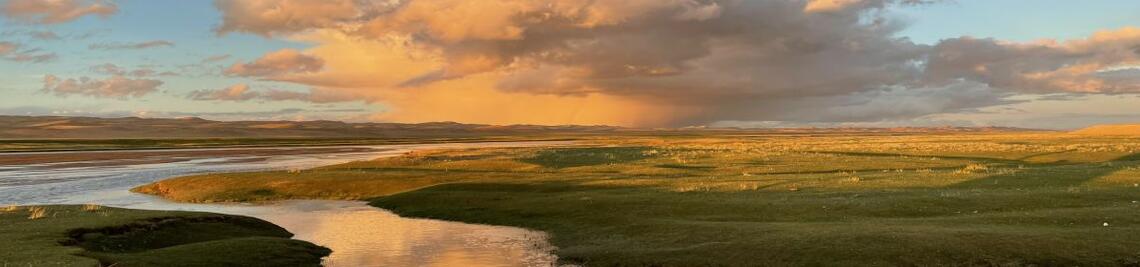
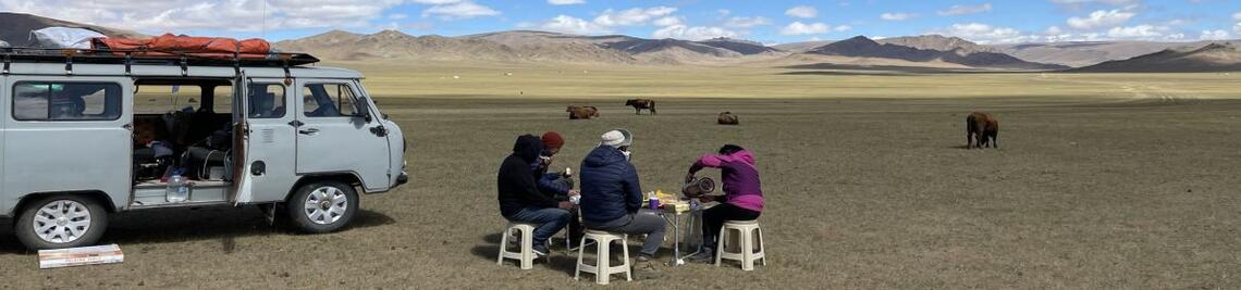
The Orog-Nuur Basin in southern Mongolia was selected as the test area. The region is characterised by a variety of different land surfaces and geomorphological processes. These include former lake sediments, which are modified by current periglacial processes, dunes, large gravel beach embankments and, in particular, a large number of different alluvial fan surfaces. The various surfaces will be geomorphologically recorded and described in detail on site. One focus of the work is the creation of high-precision orthophotos and digital terrain models from drone images. As the surface roughness strongly influences the backscatter signal of the SAR system, detailed roughness analyses for different spatial scales can be carried out with the help of the terrain models. Finally, the terrain findings and the morphometric analyses are compared with the radar data in order to achieve a precise characterisation of the different surfaces from remote sensing data. If the radar data prove to be suitable for a detailed characterisation of the surfaces in dry areas, this will provide a new method for detailed monitoring of these sensitive landscape areas. Especially in areas with high variability, a detailed and temporally dense observation series, such as that offered by the Sentinel system, is of great importance.
.")
Publications
Ullmann, T., Stauch, G., 2020. Surface Roughness Estimation in the Orog Nuur Basin (Southern Mongolia) Using Sentinel-1 SAR Time Series and Ground-Based Photogrammetry. Remote Sensing 12, 3200. https://doi.org/10.3390/rs12193200
